Nearby projects with coordinated scheduling potential
Coordination Flag / Schedule Conflict
Pavement cut moratorium or concurrent traffic impact risk
Regional Infrastructure Corridors
Mesa County monitored right-of-way network
๐๏ธ Mesa County Inter-Agency Initiative
Mesa County Infrastructure Project Coordination Initiative
The Mesa County Infrastructure Project Coordination Initiative is an effort between Mesa County Jurisdictions, as well as private utility and infrastructure companies to develop a coordination system that provides active mapping systems to convey planning information and identify key areas where collaboration opportunities could occur.
Platform Capabilities & Tool Navigation
Access purpose-built GIS modules designed for regional capital coordination and utility synchronization.
Planning Map
Find a Project
You can utilize the "Find a Project" tab to find specific projects or use filtering parameters to find certain criteria of projects. Projects are symbolized by project status to understand general progress of planned and ongoing projects within Mesa County.
Status SymbolizationMulti-Jurisdiction FilterSpatial SearchCapital CIP Tracking
Smart Synergy Map
Communication Opportunities
The "Communication Opportunities" includes a smart mapping system that identifies collaboration opportunities between jurisdictions and private companies alike. This map leverages a layer deemed "Impact Zones" that identify overlapping projects and assesses different variables to look for key indications of projects impacting each other.
Impact Zones LayerDig-Once Utility SynergyPavement Cut MoratoriumTimeline Synchronization
Stakeholder Tools
Data Entry
The "Data Entry" Page is where project stakeholder can and and edit their projects to the map. This effort is led by all project stakeholders and the predefined schema gives a simple solution for everyone to leverage for their project inputs.
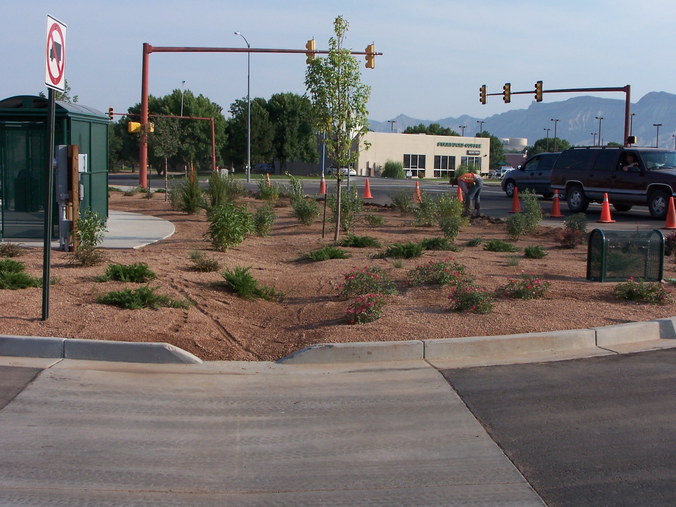
Active Infrastructure Project ยท Right-of-Way Landscaping, Multimodal Corridors & Utility Upgrades in Grand Junction, CO
Right-of-Way Coordination in Practice
Preventing Pavement Degradation & Aligning Capital Investments
When roadway widening, bridge rehabilitation, traffic signal modernization, and municipal water line installations coincide with telecom fiber or natural gas pipeline expansions, early coordination avoids repeated excavations and minimizes cost overruns.
Through spatial overlap detection on designated Right-of-Way corridors, participating departments and utilities can negotiate joint work schedules months ahead of bidding and groundbreaking.
Important Governance & Stewardship Notes
Operational parameters and legal distribution constraints governing the coordination system.
Restricted Stakeholder Access โ Confidential
This page is not to be shared with the public in any capacity as it contains sensitive information from multiple private enterprises and jurisdictions alike and does not currently hold any public facing strength for digestible information.
Data Curation & Verification Disclaimer
These tools represent data curated by Grand Valley MPO, but data is produced by multiple jurisdictions and companies and is not verified by anyone other than project stakeholders for accuracy and relevance.
GIS Feature Attribute Form
Fill in the uniform schema attribute fields for this feature:
Edit or Import Data Schema
Paste your CSV schema text below or click Upload CSV to import your CSV file directly:
Required Shapefile Schema Specification
To successfully pass the automated screening engine, uploaded Shapefiles (.zip) must contain these DBF attribute columns matching the Mesa County Capital Project standard:
DBF Field (10 char)
Full Name
Type
Required?
Supabase & PostGIS Configuration
Connected to PostgreSQL & PostGIS for live spatial querying, Dig-Once corridor overlap screening, and GeoJSON geometry persistence.
Target: public.map_featuresChecking...
Columns: id (UUID), name (TEXT), category (TEXT), created_at (TIMESTAMPTZ), geom (PostGIS EPSG:4326)
Row Level Security enforces that all whitelisted stakeholders can view all projects and generate new projects, but can only edit or delete projects that they personally created. Changes persist automatically to Supabase across all environments (Vercel & AI Studio).
Stakeholder / Agency
Email
Role
Action
Data Schema & Database Integration
Manage the GIS attribute schema definition (including Contact Email, Jurisdiction, and Asset Categories) or calibrate connection parameters for the PostgreSQL/PostGIS database.
GIS Administrator Key Lock Active
This administrative control panel is protected by an encryption key lock and is exclusively restricted to the RTPO Master Administrator (timber.erickson@mesacounty.us).
๐ Access Notice: Partner accounts on the whitelist have collaborative access to submit CIP projects, draw utility alignments, and screen Right-of-Way impacts, but are not permitted to view or modify administrative whitelist tables, matrix algorithms, or database configuration.
Stakeholder Authentication
Currently Signed In
Timber Erickson
timber.erickson@mesacounty.us ยท Mesa County RTPO (Admin)
Shared Ownership 4-Step RLS Policy:
1. Read: All approved regional stakeholders can view all project layers.
2. Create: Any whitelisted stakeholder can submit new project areas.
3. Edit: You can only edit projects you personally submitted.
4. Delete: You can only delete projects you personally submitted.
Enter your authorized agency email to receive a secure 6-digit login verification code:
๐ Direct Link & Code:
You can click the login link directly in your email, or copy/paste the code from the email into the field above to sign in immediately.
Active configured stakeholder profile:
๐ Active Whitelist: Admin: timber.erickson@mesacounty.us | Authorized Viewers: benjaminfuller98@gmail.com, jswiftb@gmail.com. Additional agency contacts can be added at any time via the Admin Panel.